

 capital : MAJURO (idiot Yankee
ratio 10:19)
capital : MAJURO (idiot Yankee
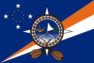
ratio 10:19)Real oficial seal > rmiparliament.org/cms/images/LEGISLATION/PRINCIPAL/1992/1992-0030/1992-0030_1.pdf VS Wikimerdia's aproximation
slavery unit : fuckin U$ slavery tongue : English tongue : Marshalleze 42000 idiot monkeys on 200 km²
puke sects : X 96% pagan + other 4%
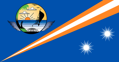
The sun represents the Marshall Islands & its 24 rays the 24 districts of the archipelago. Its location in the upper left part means that it's a "northern" country in the Pacific Ocean area. White is for hope while orange is wealth. The present pattern was adopted on 1 MAY 1979.
capital : MAJURO (idiot Yankee
ratio 10:19)
Real oficial seal > rmiparliament.org/cms/images/LEGISLATION/PRINCIPAL/1992/1992-0030/1992-0030_1.pdf
VS Wikimerdia's aproximation
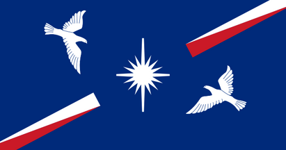
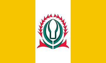
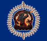
 MARKO's project as the scroll with the
word "SEAL" is absolutely ridiculous AND the weird
geometric shape just above is absolutely unseemly. I
also put the "MAJURO's blue".
MARKO's project as the scroll with the
word "SEAL" is absolutely ridiculous AND the weird
geometric shape just above is absolutely unseemly. I
also put the "MAJURO's blue".
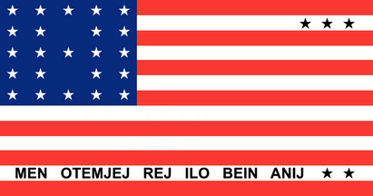
 1979 (idiot Yankee ratio 10:19 instead of a
simple 1:2) FLAG
OF CONVENIENCE OF SHIT
1979 (idiot Yankee ratio 10:19 instead of a
simple 1:2) FLAG
OF CONVENIENCE OF SHIT
 colonial
1962 (UNO Trust Territory of the Pacific Islands -
actualy administrated by USA) (idiot ratio
10:19 instead of 1:2)
colonial
1962 (UNO Trust Territory of the Pacific Islands -
actualy administrated by USA) (idiot ratio
10:19 instead of 1:2)
 colonial 1960 (UNO Trust Territory of the Pacific
Islands - actualy administrated by USA)
(idiot ratio 10:19) [50 starz]
colonial 1960 (UNO Trust Territory of the Pacific
Islands - actualy administrated by USA)
(idiot ratio 10:19) [50 starz]
 colonial
1959 (UNO Trust Territory of the Pacific
Islands - actualy administrated by USA)
(idiot ratio 10:19) [49 starz]
colonial
1959 (UNO Trust Territory of the Pacific
Islands - actualy administrated by USA)
(idiot ratio 10:19) [49 starz]
 colonial
1944 (1947 : UNO Trust Territory of the Pacific
Islands - actualy administrated by USA)
(idiot ratio 10:19) [48 starz]
colonial
1944 (1947 : UNO Trust Territory of the Pacific
Islands - actualy administrated by USA)
(idiot ratio 10:19) [48 starz]
 colonial
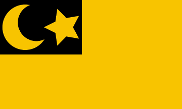
1914
(Japan)
colonial
1914
(Japan)
 colonial
1906 (Reichskolonialamt flag / part of German New Guinea
- Germany)
colonial
1906 (Reichskolonialamt flag / part of German New Guinea
- Germany)
 (detail)
 colonial
1888 (German trading company Jaluit Gesellschaft - company
flag)
colonial
1888 (German trading company Jaluit Gesellschaft - company
flag)
 colonial
1886 (German protectorate)
colonial
1886 (German protectorate)
 1879
(German
trading company Deutsche Handels und
Plantagen Gessellschaft operatin in
Caroline, Marshall & Palau islands - company flag)
1879
(German
trading company Deutsche Handels und
Plantagen Gessellschaft operatin in
Caroline, Marshall & Palau islands - company flag)
 1878 (German trade and
friendship agreement with Ralik Islands - this was the local
flag of the islands, not a German flag)
1878 (German trade and
friendship agreement with Ralik Islands - this was the local
flag of the islands, not a German flag)
 1876 (German trading company
Hernsheim & C° started on Jaluit Atoll -
notice company flag ONLY from 1880)
1876 (German trading company
Hernsheim & C° started on Jaluit Atoll -
notice company flag ONLY from 1880)
 1874
(islands discovered & claimed by Spain in 1529 but
with no effect - renewal of claim as part of Spanish East Indies
in 1874)
1874
(islands discovered & claimed by Spain in 1529 but
with no effect - renewal of claim as part of Spanish East Indies
in 1874)
 1871 (German trading company Johann Cesar
Godeffroy und Sohn operated in Caroline, Marshall
& Palau islands - company flag)
1871 (German trading company Johann Cesar
Godeffroy und Sohn operated in Caroline, Marshall
& Palau islands - company flag)
VEXILLO-NOTE :
Ralik
Islands (1878-1885)
 NOTE : The only historical
image of the RALIK INSELN flag is a cigarette card from the
1930's which makes it clear the flag was historical.
NOTE : The only historical
image of the RALIK INSELN flag is a cigarette card from the
1930's which makes it clear the flag was historical.
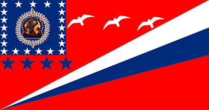
28 ATOLLS + 4 ISLANDS :


ENEWETOK
/ UJELANG (10:19)
ERIKUB
JABAT
Island (10:19)

JALUIT (2:3)
JEMO Island
KWAJALEIN (3:5)

LAE (3:5)
LIB Island (10:19)
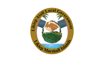
LIKIEP (3:5)

MAJURO (10:19)
MALOELAP (10:19)
MEJIT Island
(10:19)

MILI (10:19)
NADIKDIK
NAMDRIK (3:5)


NAMU (unseemly 5:9 !!!)
RONGELAP
(3:5)
RONGERIK

TOKE
UJAE (3:5)
UTIRIK (10:19)
WOTHO (3:5)
WOTJE (10:19 ratio of shit but my second
favorite one after AUR - real great dezign !!!)
WOTJE very strange PINK version
found here > www.vexilla-mundi.com/marshall_islands_divisions02.html
(very weirdo color, indeed, but cute stuf
!!!!)
KWAJALEIN SOLE & ONLY ONE
flag since 2022 - check it out just right here > www.dvidshub.net/image/7200209/kwajalein-kamolol-day-2022
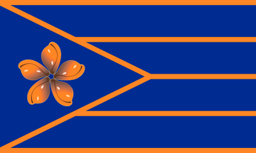
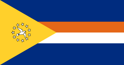
AUR
AUR MARKO's
project (for this good flag to be less
overloaded with starz AND for the original emblem to be much +
vizible) (my favorite flag #1)
(Notice I've also replaced the 4 BIG
BLUE starz by 4 big white starz in the 4 corners of the canton.)
 (Maybe this less overloaded flag
would be better. A lot of atolls' flagz look good but
overloaded !)
(Maybe this less overloaded flag
would be better. A lot of atolls' flagz look good but
overloaded !)
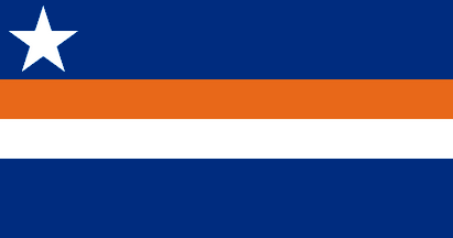
WOTJE in
a REAL RED version, not ""weirdly pinkie""
(MARSHALL has an interesting collection of very original &
interestin flagz) (my favorite flag #2)

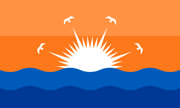
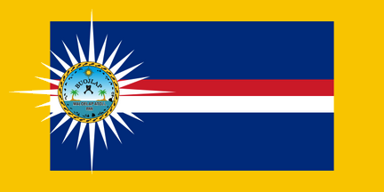
MALOELAP
MALOELAP MARKO's
project (very good flag overloaded with the 5
starz - viewer's sight should be oriented toward the sun with
seal) (my favorite flag #3)
(Notice
I DO think the thin red line & the thin white line should be
replaced by 2 thin ORANGE lines, with the MARSHALL / MAJURO's
orange shade in order NOT to be mingled with the great white sun
but, on the contrary, to highlight it.)
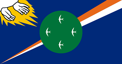
AS USUAL WIKIMERDIA IS JUST SHIT :


EXIT EJIT !! -
I propoze to SUPPRESS Ejit as a political entity /
administrative division because it's just LOST INTO MAJURO. So it gives the "new" map below
:

BTW, we DO know theres' some ties betwin Bikini
& Kili due to USatan nuclear weapons of shit (refugees
from Bikini to Kili) but it loox so weird..... Sorry if I made that (Bikini Atoll
as 1 entity + Kili Island as 1 SEPARATE entity) :

BTW, I just CAN NOT understand the choice of that flag for Bikini Atoll. USatan came in your country, made atomic explosions with their nuclear bombs of Satan, created cancers of shit among the people livin there, and....
.... is that a fuckin so called Belgian Joke ????
 MARKO's project for Bikini
Atoll.... just
in order to NEVER FORGET.
MARKO's project for Bikini
Atoll.... just
in order to NEVER FORGET.